
What Makes the Blue Ridge Parkway Special
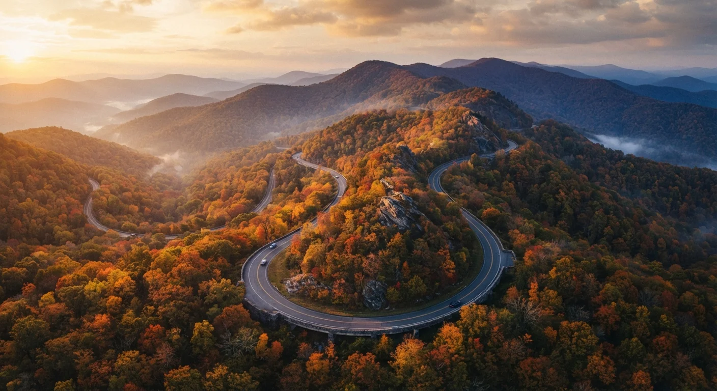
Stretching 469 miles from Shenandoah National Park in Virginia to Great Smoky Mountains National Park in North Carolina, the Blue Ridge Parkway is administered by the National Park Service and routinely ranks among the most visited units in the entire national park system. What sets it apart from a typical highway trip is its design philosophy: no billboards, no stoplights, no commercial vehicles. Every curve was engineered to keep the mountain scenery front and center.
Elevations along the route range from roughly 650 feet near the James River in Virginia to over 6,000 feet at Richland Balsam in North Carolina — which means the landscape, climate, and even the seasons shift dramatically as you travel south. Hardwood forests give way to spruce-fir summits, and roadside farm pastures transition to dramatic rocky outcrops. For travelers, that variety is the whole point.
469 miles
Total length of the Blue Ridge Parkway
According to the National Park Service, the Parkway spans two states across Virginia and North Carolina.
6,053 ft
Highest elevation point on the Parkway
Richland Balsam Overlook in North Carolina is the route's loftiest point, accessible by car.
Top 5
Ranking among most-visited NPS units
The Blue Ridge Parkway consistently appears among the most visited units in the National Park System annually.
Northern Virginia Segment: Shenandoah to Roanoke
The Parkway officially begins at Rockfish Gap near Waynesboro, Virginia (milepost 0), where it picks up from Skyline Drive. This northern stretch rolls through pastoral farmland and hardwood ridges, and the driving is gentle — a good warm-up for what lies ahead. Otter Creek (around milepost 60) offers one of the prettiest easy riverside walks on the entire Parkway, and the James River Visitor Center at milepost 63.6 sits at the lowest elevation on the route.
Approaching Roanoke, the Virginia's Explore Park and the Roanoke Valley Overlooks give sweeping views of the city below. Roanoke itself is an excellent base: it has a walkable downtown, a farmers market, and the Taubman Museum of Art, all within easy reach of the Parkway entrance.
If your schedule allows only one day on the northern Virginia segment, prioritize a morning departure from Waynesboro — mist in the valleys burns off beautifully by mid-morning and the light for photography is exceptional before noon.
Morning light on east-facing ridges is significantly more dramatic, and early starts help avoid afternoon haze that can flatten the long-distance views.
Keep your gas tank above half at all times on the Parkway — fuel stations in small mountain towns can be few and far between, and some close early.
There are no gas stations on the Parkway itself, and going into reserve territory in a remote mountain section can leave you stranded without cell service to call for help.
Southern Virginia Segment: Roanoke to the NC Border
South of Roanoke, the Parkway grows more rugged and remote. The Mabry Mill area (milepost 176.1) is one of the most photographed spots on the entire route — a working gristmill beside a quiet millpond, surrounded by demonstrations of traditional Appalachian crafts on weekends. It's a genuine window into mountain heritage, not a reconstruction.
The Rocky Knob Recreation Area around milepost 167–169 offers camping and some excellent ridge-top hiking. Further south, Cumberland Knob near milepost 217 marks the first section of the Parkway ever constructed, back in 1935 — a meaningful stop for history-minded travelers. The region around the Virginia–North Carolina border is also where the road starts climbing noticeably higher, and the views open up dramatically.
Winter and Storm Closures Are Common
Sections of the Blue Ridge Parkway can close with little notice due to ice, snow, or storm damage — particularly at higher elevations in southern Virginia and North Carolina. Closures can last days or weeks. Always check the National Park Service's official road conditions page before setting out, and have a flexible itinerary that allows for rerouting through nearby US highways.
Northern North Carolina: From the High Country to Asheville
Crossing into North Carolina, the Parkway enters the High Country — a cluster of communities including Boone, Blowing Rock, and Banner Elk that sit at elevations above 3,000 feet. Grandfather Mountain (accessed near milepost 305) is a popular side trip, featuring a mile-high swinging bridge and diverse wildlife habitats. Note that Grandfather Mountain is privately managed and charges a separate admission fee.
The Linn Cove Viaduct at milepost 304.4 is a genuine engineering marvel: a segmented concrete viaduct built hugging the flank of Grandfather Mountain to protect the sensitive slope, completed in 1987 as the last section of the Parkway to open. Driving across it feels almost surreal. Further south, Linville Falls (milepost 316.4) rewards a short hike with dramatic multi-tiered waterfall views, and the Museum of North Carolina Minerals at milepost 331 is free and surprisingly fascinating.
“The Blue Ridge Parkway is America's favorite drive — not just for its scenery, but because it invites you to slow down, stop often, and actually experience the landscape rather than pass through it.”
— National Park Service Interpretive Staff, Blue Ridge Parkway, National Park Service
Southern North Carolina: Asheville to Cherokee
The stretch near Asheville is the Parkway's busiest, for good reason. The city offers an exceptional food scene, walkable neighborhoods, and proximity to multiple trailheads. The Folk Art Center at milepost 382 showcases traditional and contemporary Southern Appalachian crafts — free to enter, genuinely impressive. Just south of Asheville, the Parkway climbs into the Pisgah District of Nantahala National Forest, and the scenery turns more dramatic with every mile.
Mount Pisgah (milepost 408) is a rewarding hike with a fire tower summit view. The Parkway's highest point — Richland Balsam Overlook at 6,053 feet, milepost 431.4 — is often cool even in July. Finally, the Parkway concludes at Cherokee, North Carolina (milepost 469), gateway to Great Smoky Mountains National Park and the Eastern Band of Cherokee Indians' homeland, where cultural sites and museums offer meaningful historical context.
Time Your Visit for Shoulder Season
Late September through late October delivers peak fall foliage, but also peak crowds near Asheville and Boone. For a quieter experience with still-gorgeous color, aim for the first two weeks of November at lower elevations, or late June for rhododendron blooms at higher elevations. Spring wildflowers in April and May are another underrated highlight — and lodging rates are generally lower outside peak foliage weekends.
Planning Your Trip: Logistics and Practical Tips
The Parkway has a 45 mph speed limit throughout, and that's intentional — budget significantly more time than a mileage-to-hours calculation suggests. Most travelers split the full route over four to seven days, staying in gateway towns or Parkway campgrounds. There are nine developed campgrounds managed by the National Park Service; reservations are recommended in peak season.
Fuel is not available on the Parkway itself, so fill up in every town. Cell service is spotty across long stretches — download offline maps and the NPS App before you go. Conditions can change quickly at elevation: pack layers even in summer, and check the NPS Blue Ridge Parkway road conditions page before each day's drive. Some sections close in winter, and storm damage can cause temporary closures at any time of year. Always verify current status through official National Park Service channels before departing.
No Entry Fee, But Plan for Costs
Driving the Blue Ridge Parkway is free — there are no tolls or entry gates. However, some developed areas including campgrounds, the Grandfather Mountain attraction, and certain recreational facilities charge fees. Budget for lodging in gateway towns, meals, and any side attractions. An America the Beautiful annual pass covers entrance fees at associated NPS sites but does not apply to privately managed attractions along the route.
NPS Blue Ridge Parkway Official Site
The National Park Service's official Parkway page covers maps, road conditions, campground reservations, and visitor alerts — the authoritative source for trip planning.
Recreation.gov Campground Reservations
Use this federal reservations platform to book campsites at the nine NPS-managed campgrounds along the Parkway, especially important for peak season travel.
NPS App (Mobile)
Download the free NPS App for offline maps and Parkway guides — essential for stretches with limited or no cell coverage.